|
“Fair Winds and Following Seas”
The Log of Chip Ahoy’s 2005 Great Maine Cruise
Thursday, July 21, 2005; 6:30 am
DiMillo’s Marina
Portland, Maine
Wally Riddle and I
left Marblehead with Chip Ahoy in tow
at 8:00 yesterday morning, and arrived at Portland Yacht Services by
10:30. Rob, the service manager, and Tim, one of the hands there, were
graciously friendly and greatly helpful. The Chip Ahoy website and the
work I’ve done on the boat were well known by them! It was a scorcher of
a day – sunny and in the 90s – but we had the mast up and the
boat
rigged by 2:30 and I was on my way. While backing the boat and trailer
down the ramp and into Casco Bay, both Wally and I failed to look up –
where the yard had a crane overhead for stepping masts and hadn’t swung
it out of the way when they last used it. Sure enough, Chip Ahoy’s mast
caught it, fortunately doing no damage any of us could see, but it
created a less than auspicious beginning.
Before launching, I called nearby DiMillo’s Marina to make sure they
still had a spot for me reserved. I was assured they did and were
expecting me, advised of my slip number, and told I’d be docking on my
port side. I hung a pair of fenders and ran my dock lines in
preparation. About halfway there out in the Bay, I radioed ahead as
requested (Channel 71) and told them I was coming in – to which I was
advised that I’d be docking now on my starboard side. While I was
scurrying about up at the bow to change preparations, the marina radioed
Chip Ahoy and asked me to “stand by” – my slip was no longer available!
About ten minutes later while I circled out in the bay, they radioed
back that they had another slip for me – that I’d be docking on my
portside after all, aaarrrgh.
I arrived at my slip (D2) around 3:30 pm and first thing, set up the
“pup tent” just to block the intense sun, reflective side up – the first
time I’ve used it for other than rain. I replaced the solar vent on the
bow, which exhausts air out, with the air scoop to try directing some
air into the cabin. Without that forward hatch most Catalina 22s have,
it gets stifling inside. A hatch is definitely on the top of next year’s
to-do list!
I settled up with the marina office and was given the password for its
wireless service. I couldn’t wait to see how it worked, so pulled out
the laptop and gave it a whirl. It connected to the Internet just fine –
but none of my e-mail accounts would work! I spent the next few hours
trying to get them to send and receive, humped the laptop up to the
office in the hope of assistance, but in the end I just wasted my time:
I am not going to be doing any e-mail here. Up at about 4:30 this
morning, I had another determined go at it – and just wasted more time.
In the end, I picked up a Yahoo.com web-based e-mail address, subscribed
myself to the C22 discussion group with apparent success, and will use
it at least while here until tomorrow morning.
Surprisingly, the EPIRB I rented from BoatUS Safety Foundation – that
was supposed to arrive at DiMillo’s office today and I hoped wouldn’t
hold up tomorrow’s departure by not getting here – arrived yesterday!
Rick, one of the marina’s staff from last year, brought it down to the
boat and asked if I was also “Robert” Ford, a package for him had just
arrived.
Last night I walked out to Freddie’s Chowder House in “Old Port” – one
of my haunts from last year up here that serves great chowders. I spoke
on the cell phone with Aaron Mosher from the list and he thought he’d
stop by, but would call back when he got here so I could let him through
the security gate. I didn’t hear back from him and that was just a well
as I was exhausted when I got back aboard and went right to sleep, hatch
open with a refreshing breeze wafting in.
I’ve got lots to do here today to get ready for tomorrow’s departure and
the real beginning of this cruise. First thing is to adjust the standing
rigging (we just tightened all the shrouds enough yesterday to get the
boat over here), and put the covers on the battery buss blocks (I just
connected the switch wiring and outboard’s battery cables and left the
finishing up details for over here). I’ve got to put the cover on the
dinghy and accomplishing that with the dinghy in the water will be
tricky I expect. I’m going to have to find a system if it’s to be of
much use. There’s much general straightening up and organizing that
needs to be done before I get underway.
Friday, July 22, 2005; 5:15 am
DiMillo’s Marina
Portland, Maine
Yesterday I finished up everything that needed to be done to have the
boat ready for this morning’s departure, all but for adjusting the
shrouds (primarily the forward lowers). I had to move the boat to a
different slip in mid-morning, which is always a nuisance – taking down
the “pup tent” being the biggest, especially when I have it rigged
perfectly. But it gave me a chance to start the dinghy’s outboard when I
ran the dinghy over separately after securing Chip Ahoy. (I’d not had
the chance since the motor was serviced last winter, as the dinghy never
left my yard until we loaded it on top of Chip Ahoy’s cockpit for the
ride up here.)
Just before 1:00 pm Aaron Mosher (“Euphoria”) called and we met at last
for lunch at Three Dollar Dewey’s, just down Commercial Street from the
marina, then returned to Chip Ahoy, where he took a look around. He
convinced me not to cover the dinghy, as the weather forecast has no
rain in sight until mid-week at the earliest and I’ll probably be using
it before then anyway. His real convincer was, “If you wrestle it on,
you won’t want to take it off again.” So true.
Mid-afternoon I began plotting my course for today, first picking Five
Islands Harbor on Sheepscot Bay as my destination from the information
in “A Cruising Guide to the Maine Coast.” Once I’d plotted my course
there on the chart, entered the waypoints and plotted my route on the
laptop, I uploaded it to both handheld GPSs. It’s about a 30 mile run to
reach what I hope will be a free mooring at the Five Islands Yacht Club
behind Malden Island.
On the other side of the face dock where the marina moved me is a huge
ship (it’s too big to call it a boat), the
“Mystique” from Jaluit (one
of the Marshall Islands in the South Pacific), though its captain told
me the ship has never been outside U.S. waters. This private yacht is so
big it’s even got its own wireless signal that I’m picking up on my
laptop.
Last night, after completing my course plotting, I again walked over to
my favorite chowder house for a quick dinner then turned in at around
10:30, ready and anxious for an early start this morning. I’ve already
showered and it’s time to start stowing gear and getting Chip Ahoy ready
for today’s trip.
Saturday, July 23, 2005; 0515
Five Islands Harbor Yacht Club mooring
Five Islands, Maine (27.9 nm)
[Chart]
I left DeMillo’s Marina yesterday at 10:00 am and once into Casco Bay
hoisted sail. Unfortunately, the 5 mph (approx.) breeze was coming from
the south, the direction I was headed out of the bay and into the Gulf
of Maine. Once past the sea buoy I headed easterly toward
Halfway Rock
and points beyond. The weather was beautiful for most of the day, though
the winds were light. After about two hours of sailing, the GPS
indicated that at the three knots I was making, I wouldn’t reach Five
Islands until 10:30 pm at best, sometimes even as late as 11:30 pm.
The sky was darkening over land to the northwest, NOAA weather radio was
warning of an approaching cold front that would bring with it scattered
showers and thunderstorms, some extreme. I started the motor and
motorsailed the rest of the way. The sail/motor combination kept me at 5
knots and promised an arrival time of just after 5:00 pm, much more to
my liking.
The sky became somewhat overcast with thin cloud cover that came and
went for the afternoon. I arrived at the small, quaint Five Islands
Harbor at 5:30 and looked for one of the five or so blue styrofoam
moorings the yacht club provides as a courtesy to visiting boaters. The
only one I found available off the yacht club had no pennant. Leaving it
behind, I tangled with a lobster buoy, fortunately freeing it by
shifting the outboard into neutral, forcing the buoy under it, then
quickly swinging up the rudder to free it.
The next free mooring I came across, further out in the small and
well-sheltered harbor, had no pennant either – but this time I was
prepared with one of Chip Ahoy’s dock lines if needed. As I was
attaching it, one of the club's members rowed out and took me to a free mooring
closer to the yacht club – again with no pennant. I used Chip Ahoy’s
dock line and was quickly secured.
Lesson: Instead of running one end of the line through its spliced
eye to secure it as a pennant, I should have run the line around the
mooring ball a couple of loops then tied off both ends to Chip Ahoy’s bow cleats. I just
changed it over, with satisfaction saving my dock line and making my
departure that much more trouble-free.
No sooner had I secured the boat when thunder rumbled off in the near
distance; though sunny overhead, the sky to the north was dark and
ominous as the wind picked up. I quickly stowed everything below, setup
the “pup tent,” and turned on the radio. NOAA was now warning mariners
in the area to immediately head for shore, that a string of violent
storms was approaching “with winds up to 35, frequent lightning strikes,
and building seas.” Then it arrived, starting with a downpour and
building winds, lightning strikes around us not too far off. I made a
bite to eat and sat it out in the cabin, thanks to the “pup tent” with
the sliding hatch closed but the cribboards out letting in some air and
providing a front seat view of the brief storm. After reading for a
while, I soon fell asleep, around 9:00 pm.
This morning I rowed off a bit and took some
photos of Chip Ahoy at its
mooring, then plotted my course to Boothbay Harbor, to where I’ll soon
depart and spend the night if I can find a slip. I’ll call Boothbay
Harbor Marina in a little while, and if nothing’s available there, try
Tugboat Inn Marina nearby.
I used the inverters I bought for powering the laptop and other 110 volt
equipment for the first time this morning and both worked spectacularly
(whenever anything works as its supposed to out-of-the-box, I consider
that spectacular). After plotting my course from here to Boothbay Harbor
(powering the laptop with the Dell/Lind inverter), I uploaded the route
and waypoints to the two GPSs (using the Sears inverter) like I was on
my home computer with household current.
It’s just a short run around Southport Island and Cape Newagen then up
Booth Bay to Boothbay Harbor, about 10 nm. The sun is shining again, the
fog slowly lifting outside the harbor. I want to fill a gas tank (after
using so much in yesterday’s run up from Portland) when the fuel dock
opens later this morning; I’ll row over with the tank and perhaps have
breakfast if available at the only other business I can see over there:
according the cruising guide, Five Islands Seafood.
Saturday, July 23, 2005; 8:15 pm
Boothbay Harbor Marina
Boothbay Harbor (8.47 nm)
[Chart]
I made it to Boothbay Harbor today at last; I have a
slip at the
Boothbay Harbor Marina. Today was a good sail, though I didn't cover a
lot of distance, making it just to Boothbay Harbor maybe 11 miles on my
route, but they were long, rough ones. This has always been one of my
layover destinations for this cruise, where my old 60' Alden schooner
was built in 1926, Hodgdon Brothers Shipyard still in business. Leaving
Sheepscot Bay literally was a breeze with the 15-20 knot wind gusting
from the north at my back, and rounding Southport Island was a
sleighride. But then I had to sail back north up Booth Bay right into
the teeth of the wind. After a lot of exciting tacking, in the end it
was time to start the motor to get here sometime today.
I’d reserved a slip from “Lew” while still at Five Islands Harbor and it
was waiting for me upon my arrival. But, I no sooner stowed things away,
set up the “pup tent,” and paid my bill when Lew, the marina’s owner
along with his wife, asked me to move the boat to another slip to make
room for a bigger boat. (Aren’t they all?) I told him I was starving and
wanted to eat first. When I got back to Chip Ahoy and its apparently
very transient slip, I decided not to move a thing until I first spoke
with Lew again – the way things were going, he’d probably changed his
mind already, and I wasn’t about to repeat the needless exercise all
over again (like when approaching DeMillo’s Marina in Portland). Sure
enough, now he wanted to put Chip Ahoy in a third location!
Finally settled in at my dock, I am disgusted. I later had to move the
boat back one cleat to make room for the tourist schooner when it
returned from one of its many daily excursions. I’m closed in by dock
pilings supporting restaurants above and a bar, bow out so my line of
sight from the cockpit or cabin are the structural floor bottoms and
pilings, the waterfall soundtrack in the background is some sort of
waste water drainage. All afternoon a 70s rock band blasted away
somewhere above me, though it has been silent for an hour now, thank
god. When I look out and up, there are diners and other tourists gawking
down at me from the outside deck. If this is “getting away,” take me
home – it’s quieter and more peaceful there!
Boothbay Harbor is overall quite a real disappointment: lots of kitschy
trinket giftshops and high cuisine-type restaurants. Far from what I'd
expected – very little real Downeast Maine atmosphere here, or I haven’t
found it yet. I’d always planned to spend two days here when and if I
arrived. I paid for two days ($88) . I’m rethinking that plan.
Sunday, July 24, 2005; 6:15 am
Boothbay Harbor Marina
Boothbay Harbor
A late start this morning, for good reason. I was up until 2:00 am when
the bar/club above me finally tossed the drunkards out. Music pounded
away only yards off with a deckful of noisy revelers just above and
getting closer as the tide lifted Chip Ahoy prohibited sleep – or even
thinking straight. I want out of here today; I’d rather be home on my
mooring!
I took a walk around town last night looking for a place to eat dinner
that wasn’t too kitchsy (there’s that word again!). The quick lunch I
grabbed at McSeagull’s Restaurant after settling into my first slip left
me unimpressed and the service – if that’s what it’s called – was
terrible while all the wait staff sat around one table kabitzing. That
was my very last resort short of coming back to the boat and making a
sandwich. I ended up at the J.H. Hawk Restaurant and Pub, right above
Chip Ahoy, for a good steak. By the time I was done, the maitre de
invited me to use a back exit “to avoid the crowd,” and that’s when I
noticed how much the pub side had filled up, how noisy it was in the
next room.
Back down below on the dock and aboard Chip Ahoy, it was all happening
right above me, blasting down, showering me with its cacophony as the
rising tide lifted me inexorably closer to the source. The later it got,
the more crowded the deck above got and the noisier it became. It was
too loud even to concentrate on reading. I’m out of here today.
Monday, July 25, 2005; 5:00 am
Brown’s Wharf Marina
Boothbay Harbor, Maine
Early yesterday morning the talk around the marina was about a
hard-bottom inflatable that had been stolen the night before, recovered
by its owner across the harbor left abandoned, with a little marijuana
in a baggie left behind. I told them that I thought I may have seen the
thieves on my return to Chip Ahoy after dinner the night before; five
guys in their mid-20s had an inflatable pulled up right behind my boat
and were piling in it, then they quickly drove it off at about 9:30. A
short while later a policeman stopped by and interviewed me. I
apologized that I couldn’t help more with descriptions, but I hadn’t
suspected anything unusual was going in all the loud chaos above, I
figured these were just more revelers who’d arrived by boat – but that
it had caused me to lock my cockpit lazerette hatches, then recognizing
that as secure as the entrance gate was, anyone could pull up by water
and welcome themselves aboard any boat at the marina.
That was the final straw: it was definitely time to move out. Using
their weak wi-fi signal, I looked up Brown’s Wharf on the Internet, got
their phone number, called and they had an empty slip as soon as I
wanted it.
That was the best move I could have made, jumping just across the harbor
to a peaceful paradise. At 11:00 am I left Boothbay Harbor Marina with
Ray’s promise to have Lew refund a day’s dockage from my credit card
when he got in. About ten minutes later I pulled into
Brown’s Wharf Marina where Bob, the owner, and a dock hand were waiting to help me dock and
tie up at a nice inside dock handy to the ramp, restaurant and
facilities. The per-day cost including electricity and wireless is only
nine bucks more ($2.45 vs. $2.00 per foot) than I paid across the harbor
beneath the rock-and-roll concert emporium.
The owners were thrilled that I found their marina using its wi-fi
service from across the harbor and looked them up on the Internet; they
can’t wait to tell the techie who set it up for them – he’ll be even
more thrilled they said. This place even has a computer in its lounge
for guests to use.
I spent part of the day plotting my next route to Port Clyde off Hupper
Island in Muscongus Bay, just west of Mosquito Island (which doesn’t
sound very inviting). It’s about a 22-mile run, but I think I’ll spend
another day here for a couple of reasons.
First, the weather doesn’t look very promising. A small craft advisory
is up for this afternoon as a frontal system moves through from the
west. It’s forecast to be cloudy with showers and thunderstorms
accompanying the front, wind south at 10-15 mph changing to west and
increasing to 15-20 later today. By Wednesday a new high pressure area
will move in that supposedly will provide beautiful weather through the
weekend and into early next week. Tomorrow is forecast to be sunny with
10-15 mph winds from the south; the usual “chance of scattered showers
and thunderstorms late in the afternoon” seems to append every forecast.
The second reason is, Bob the marina owner offered to arrange a ride for
me to the Hodgdon Brothers Shipyard in East Boothbay – the builders of
my old 60' Alden schooner back in 1926 – about five miles from here. I’d
told him how I’ve always hoped to visit there if I ever got to Boothbay
Harbor. He was enthusiastic that I do, and offered me a ride. I think
I’ll stay another day and take him up on his offer.
After completing my charting chores, I learned that the nearest grocery
store was back across the harbor, right behind Boothbay Harbor Marina –
about a two mile walk around the harbor and over its famous footbridge.
Instead, I took the dinghy and motored across in a few minutes, tied up
at the town dock, and picked up the perishable basics. Ice they’ve got
here at the marina.
Last evening I had dinner at the marina/inn restaurant, ordering the
surprising turkey dinner special recommended by Bob. Back aboard, I read
for a short while then fell asleep before sunset and slept until 4:30
this morning. Those late-night revelers who kept me awake into the wee
hours of Sunday morning apparently wore me out. There's a
nice sunrise going
on out there; time to get some photos.
Tuesday, July 26, 2005; 5:15 am
Brown’s Wharf Marina
Boothbay Harbor, Maine
What a fiasco yesterday turned into: it simply wasn’t in my fate to
leave even if I’d wanted to. After a great breakfast at the marina
restaurant, when I returned to the boat and called Barbara the cell
phone’s beeping informed me that its battery was again almost
discharged, dead – even though it’d been charging all night after dying
on me the night before. I always keep it on its cigarette lighter
battery charger unless sometimes when I leave the boat and take it
along. (If I’ve got shore power, the boat’s batteries are being charged
constantly by the 12v battery charger.) I’ve got a second battery for
the phone, and had the same problem with it too a couple of days ago,
and concluded that it was the battery. One of them is new, so it
couldn’t be both cell phone batteries – the phone itself wasn’t
accepting the charging.
How to make this long story short? I called Verizon Wireless and was
told that I was eligible for a free phone upgrade, just bring it in. But
the nearest Verizon store is in Brunswick, some 15-20 miles away. Ah,
they told me, but most Radio Shacks are Verizon dealers and there’s one
right in Boothbay Harbor only a few miles from me. So I took the free
local trolley shuttle, “The Island Explorer,” out to the small mall on
the edge of town, only to learn it was now a dealer for one of Verizon’s
local competitors.
After explaining my situation, the salesman was kind enough to test my
phone and declared it unable to charge, as I suspected. He agreed to
call a taxi to take me to Brunswick, but was told it’d cost $38 one way.
I told the cab company I wanted to come back too – and was told that
round-trip would cost $78. For less than that, I could rent a car for
the entire day – so that’s what I did. Enterprise had a Chevrolet Aveo
available for the day for $45 and I grabbed it – they delivered it to
the marina and I was off to Brunswick and the Verizon store.
There, they tried but were useless. The “free replacement phone” was
only if I upgraded my service contract plan – and nothing is available
that will hook up to my $300-plus truck package back home; it’s
“obsolete” after three years because my Motorola StarTac phone supposedly is.
There were complications and roadblocks to every move I came up with. In
the end – as Verizon knew I must – I forked over $200 for a new phone
and cigarette lighter charger and drove back to the boat fuming.
After putting it on the charger, I still had a car for the day so drove
over to the Hodgdon Yachts in East Boothbay. There I was met with
indifference and disinterest. I wasn’t offered or permitted a tour and
the clueless receptionist insisted “the building is too new to have been
around in 1926.” I walked around the outside of the building and was
able to see a 100-plus footer the shipworks is building, and found one
old-timer working on it who spent some time talking with me about the
yard’s history. He was quite interested that I once owned Malabar VIII
and had me write down my website where he can see the
photos of it.
On the way back to the boat, I stopped at a gas station and filled one
of Chip Ahoy’s near-empty 6-gallon gas tanks (I’d pumped most of its
remaining gas into the fuller tank, topping it off, before I left the
boat). Now I won’t have to stop at the gas dock on my way out of here,
and saved about 50˘ a gallon.
Back at Brown’s Wharf I added the two-stroke oil and stowed the tank,
took a shower, then struggled with programming the new cell phone,
spending most the evening on-hold with Verizon customer support to get
questions answered that weren’t covered in the most useless owner’s
manual I – and by acclimation, they – have ever come across. By 10:00 pm
I had it doing enough of what I need it to do and turned in to be ready
to cast off today, as soon as I get brought back from returning the car
rental at 8:00 am.
Yesterday, though extremely windy, turned out to be rain-free with no
thunderstorms even hinted at arriving. Today the forecast is for partly
to mostly sunny, fog in the morning (so no rush to depart), wind SW at
10-15 mph and seas running about 2 feet. With a warm front moving in
later today, tonight will be cloudy with “a chance of showers and
thunderstorms after midnight.” A small craft advisory my be issued for
late tonight. Tomorrow sounds quite similar. A new high pressure area
moves in on Thursday and it looks like beautiful if a bit cooler weather
straight through the weekend.
Wednesday, July 27, 2005; 6:00 am
Port Clyde General Store mooring
Port Clyde, Maine (19.1 nm)
[Chart]
“A Cruising Guide to the Coast of Maine” by Hank and Jan Taft
(updated by Curtis Rindlaub) is my trip
bible, and it informs that: “Port Clyde is easy to enter and a
reasonably good harbor. It can be miserable, however, in strong winds
from the southwest or northwest.” I was awakened at 1:30 last night by
the boat’s pitching and rolling, wind whistling through the rigging,
halyards slapping against the mast. I went up to check conditions and
the mooring, wrap a bungie cord around the halyards. A quick check of
the compass and sure enough, strong winds directly out of the southwest,
and heavy fog. It’s still foggy, though it seems to be lifting; the wind
has lessened but the rocking-and-rolling continues.
Yesterday, after returning the rental car, I departed Brown’s Wharf
Marina at 9:00 am. Brown’s is one of the best marinas I’ve stopped in
for a long time: great folks who bend over backward to be of assistance
and service, good facilities, reasonably priced and – free wireless Internet service to
boot.
I sailed out Boothbay Harbor, around Pemaquid Point and across Muscongus
Bay. Once across the bay it gets a bit tricky navigating through the
narrow passages between islands and rocks, with the navigational aids
going from north-south (“red, right, returning”) to east-west where you
keep red on your port heading east. The difficulty is knowing which is
which, so I had to keep one eye on the chart and stay alert as I
approached. I’d made notes in my notebook and marked my chart to remind
me as I approached them. For much of the first half of the bay crossing
I used the motor along with sails, until the wind picked up in the early
afternoon to about 10 knots, the seas building to about three feet of
long, gentle rollers from the southeast. Passing through the narrow
channels between islands required the motor, for safety but mostly to
slalom between minefields of psychedelic-colored lobster pot buoys that
seemed (and in many instances were) only feet apart, especially passing
between Thompson and Davis islands and the entrance between Hupper
Island and Port Clyde.
I arrived at about 5:00 pm, making good about 20-plus miles over the
day, and picked up one of the moorings rented to transients by the Port
Clyde General Store, per the instructions they gave me on the phone
earlier. After everything was stowed and secured, I took the dinghy over
to the store’s dock and paid my $25 for the night. Upon return to Chip
Ahoy, I plotted the next day’s course based on the Cruising Guide: it’ll
be Southern Harbor on North Vinal Island if all works out.
Today is looking iffy for a departure. A cold front will soon move in
from the west and NOAA is forecasting a 70 percent chance of showers and
thunderstorms “some severe with the potential of serious wind damage....
a small craft advisory remains in effect until late today.” (I didn’t
know one had been issued; must have been last night.) Right now the
wind is from the southwest at between 15-25 mph depending on which
location is reporting, and visibility is generally less than a mile.
Prudence seems to dictate remaining another day right here on the
mooring.
Monica called last night; actually she left a message as cell phone service
here is hit-or-miss: sometimes I get a signal, other times I don’t. When
I got her message, after a number of tries I finally was able to reach
her. She asked how I was doing, how far I’d gotten, and when I expected
to make it to South Addison. I told her I had no idea of my ETA – that
I’m just taking it a day at a time – but today is Day One of Week Number
Two of my cruise. I’ve got another two weeks ahead to make it there if I
can.
I expect a good day’s sail to reach North Haven Island, just north of
Vinal Haven Island, another two or so to reach Frenchman Bay and Bar
Harbor/Northeast Harbor. Reaching Pleasant Bay and South Addison will
probably take another three good days (rough estimate – too many pages
ahead in my Chartbook). She’s arranged with the harbormaster for a free
mooring when I arrive.
Wednesday, July 27, 2005; 7:30 pm
Port Clyde General Store mooring
Port Clyde, Maine
Prudence surely did dictate accurately this day. A severe thunderstorm
just passed over us: arriving at 5:15 pm it’s still raining and heavy
fog is rolling in. A fog horn is moaning in the background for those
unfortunate enough to still be out there. A Carver 300 pulled in a
little earlier and took the mooring nearest me. Talking across the
water, the owner said it looked like he’d arrived just in time as the
fog was rolling in fast. I told him how I’d planned to leave, but after
hearing the weather forecast this morning had decided to stay for the
day. It’s lucky that I did, he informed me: seas outside were running a
good six feet and it was blowing hard. He thought the thunderstorms
would miss us, pass us by. Half an hour later all hell broke loose with
lightning strikes all around, one very close nearby.
The first thing this morning I dinghied over to the general store and
paid for another day on the mooring. I only got here late yesterday but
the lady behind the counter gave me a big “Hey Chip Ahoy, you staying
for another day? That’s great, love to have you!” I picked up a ham and
cheese sub there for later and a quart of their fresh-made fish chowder
for breakfast.
It appears that I’ve fixed the alcohol stove, with which I’ve been
having a problem keeping the flame burning while brewing my pre-dawn
coffee. When I refilled its tank back at home, I noticed that the
denatured alcohol had a brown tint to it, like tea. Yesterday, on the
way to return the rental car, I stopped by a hardware store and picked
up a fresh gallon. This morning I dumped out the old alcohol and
refilled the stove’s tank from the new gallon – which as I thought, was
clear. After initial sputtering, the stove burned strongly.
I had a pretty relaxing day: I took some photos of Chip Ahoy from the
dinghy and a nearby lobsterman’s float; stopped in at the general store
again for more ice and a hot dog for lunch; plotted my course from North
Haven to Bass Harbor on the southwest tip of Mount Desert Island; read a
bit, and took a nap.
I’m being driven to distraction by a strange rapping noise, a sharp
knock each time the boat rolls port to starboard hard, clearly emanating
from low on the starboard side hull at the juncture where the cabin aft
seat cushion ends, the cockpit bulkhead comes down and turns under,
where a sliding galley would be stowed if one was aboard – directly
across from the winch handle panel and keel cable and drum. I can
actually feel it with my hand. It sounds like something striking the
boat from outside, but there’s nothing out there. I’ve pulled apart and
removed all sorts of things, initially thinking that something’s got to
be rolling around somewhere, but there’s nothing that could be making
that sound, any sound. Now I’m wondering if perhaps I picked up
something on the keel cable that’s striking the hull from beneath – like
one of those millions of lobster pot buoys? The keel is and has been
down, so I cranked it up and lowered it a few times, but it seems to
work normally and this hasn’t had any effect. I just called and told
Barbara and Hobie that I think the boat has become haunted and someone
or something down there is knocking for permission to come aboard!
Thursday, July 28, 2005; 5:15 am
Port Clyde General Store mooring
Port Clyde, Maine
That thunderstorm earlier was just the precursor, the opening act. It
continued to rain, but the thunderstorm that arrived at around 8:15 pm
was the star attraction. This was one of those “severe thunderstorms”
I’d been hearing was probable “later in the day and into the evening”
that accompanied the cold front that rolled in from the northwest. It
was still raging and raining so hard by the time I went to sleep, around
9:30, that I’ve got about two inches of rain water to bail out of the
dinghy this morning. (I’ve yet to use its new cover.) As spectacular as
it was, it still didn’t reach the level of
the violent storm in
Portsmouth, NH, last year while on my cruise – and probably nothing ever
will.
Soon I’ll make ready to cast off and head for North Haven, which I
should reach by late this afternoon. The sun is rising, and the sky
appears very clear, not even any fog outside the harbor: the front must
have cleared everything out. High pressure is moving in from the west
and should remain at least through the weekend. The wind, now coming out
of the north at about 9 mph, is supposed to change later to the
northwest at 10-15 mph for the rest of the day, decreasing to less than
10 later this afternoon. Beginning tomorrow it supposedly will come from
the west and southwest for the next couple of days, which will be
favorable for my course if it holds. Later over the weekend the wind
direction is supposed to change over to the northeast then become light
and variable. Tropical Storm Franklin is moving well south of us, south
of Georges Bank, and should have no effect on local weather or sea
conditions, thank god. (Whatever happened to Emily?)
I should reach Mount Desert Island on Saturday, then must make a
decision: whether to head up Frenchman Bay to Bar Harbor and/or
Northeast Harbor (where the Merliers were supposed to launch “Swizzle
Stick” so I might find them there) – as I’ve always planned to do – or
keep going along the coast to insure that I make it to Monica’s place in
South Addison. I’m leaning toward heading up around Mount Desert Island
and spending a day visiting Bar Harbor and Acadia National Park, as
planned – after all, “the cruise is about the experience, not the
destination,” as I was reminded last year. I keep telling myself that.
Besides, I’d hate to wind up at Monica’s place with a week to kill and
know I could have done the side trip if I’d just taken the time, but
will likely never do it again. Besides, if the wind turns light and
variable as forecast, it’d make for a good time to sit it out someplace
interesting instead of motoring. On the other hand, if the cold front
forecast to move in early next week produces what this one last night
did, I’ll be stuck next week somewhere else longer than expected and
will probably lose another day of sailing.
“A diver is also available if you happen to be unfortunate enough to
need one,” the Cruising Guide offers for Thayer’s Y-Knot Boatyard on
North Haven Island, where I’m heading to today and hope to pick up one
of its moorings. If that rapping on the starboard hull persists during
the day, I’m giving that diver some real consideration. I didn’t bring a
diving mask (though I kept reminding myself to get one), so I’ve got a
good excuse to not jump into this icy water.
I pulled a beaut yesterday in my obsessive search for the elusive
rapping. At the suggestion of Hobie Davidson, I tried raising and
lowering the keel – but forgot I’d tightened the locking bolt during all
the rolling and knocking of Tuesday night (I never tighten that bolt).
When I first heard it complain, I said “ah hah!” and thought I’d found
the culprit – except the sound came from behind me, forward in the
cabin, and I immediately realized I’d forgotten to loosen the locking
bolt. I quickly loosened it, but expect that the keel has now been
permanently scored. (And just what is the advantage of tightening that bolt
supposed to be, if it doesn’t hold down the keel but only scores it?)
Thursday, July 28, 2005; 5:50 pm
Thayer’s Y-Knot Boatyard mooring
Southern Harbor
North Haven Island, Maine (22.3 nm)
[Chart]
Last year I called them lobster trap buoy “minefields.” No longer am I
amidst those: now I’m running along a buoy carpet! From the moment I
left Port Clyde until just outside of Vinal Haven Island, lobster pot
buoys occupied the entire sea: there had to be at least one for every
square 10-15 yards – at least one. I had a brief respite, but then they
crowded in again as I came into here.
This is why I ran so far offshore during last year’s cruise – but this
year I’ve got to deal with running between islands, and there’s just no
getting away from the plague of lobster pot buoys.
The tiller-pilot is virtually useless: you must sit at the tiller and
steer every inch along the way, every moment of the day. This morning,
as I was leaving Port Clyde with buoys all around, I kept figuring that
just ahead I’d turn into the wind and hoist sail. I didn’t get the
chance until Gunning Rocks, where I grabbed a brief respite long enough
to get the sails up – for all the good it did. With the northeast wind I
was afflicted with all day, I was constantly sailing directly against
it. I finally doused the headsail and kicked on the motor. (Hell, I
needed the motor just to dodge the lobster trap buoys!)
As I approached (cell phone service was non-existent earlier), I called
Thayer’s Y-Knot Boatyard to arrange for a
mooring in Southern Harbor.
Permission granted, and no charge – just “grab one and have a nice
evening”! Again, incredibly nice folks.
It’s cold here since that front moved in last night. This morning when I
started, I was wearing jeans and a t-shirt. Soon I had to dig out my
“nightshirt,” a heavy winter zip-up turtleneck sweater with insulation.
Next came the foul-weather gear jacket and socks. I was just barely
comfortable all day. As I pulled into the lee of North Haven, I tossed
the jacket below; the sweater followed once I moored here. (The socks
are still on!)
This is where there’s supposed to be a diver available – but I haven’t
noticed that aggravating rapping all day. Maybe I knocked loose whatever
was causing it? Maybe the boat just isn’t rolling enough. I just don’t
know, but I’m not going to pay for a diver right now.
No “pup tent” tonight. I’m out of here first thing tomorrow morning for
Mount Desert Island, and the forecast is for nothing but nice weather.
Saturday, July 30, 2005; 5:30 am
Morris Yachts mooring
Bass Harbor
[Chart]
Mount Desert Island, Maine (23.3 nm)
I got an early start yesterday, slipping my mooring at 7:30 am and
stopping to fill a gas tank in North Haven at J.O. Brown’s fuel dock, a
real Downeast wharf with a couple big cluttered barns where they do
wooden boat work, a small office with marine hardware and supplies, and
lots of interesting junk tossed aside everywhere.
Against the advice of the woman I spoke with at Thayer’s Y-Knot Boatyard
to arrange the previous night’s mooring, I cut corners leaving Southern
Harbor, taking the narrow channel into the Fox Islands Thorofare instead
of going down past the Sugar Loaves then back up again. There was plenty
of water so I saved myself a couple miles or so down and around. The thorofare was easy enough
to navigate, despite some of the warnings I’d read about currents and
its narrowness in spots. That put me in a good state of mind for the
next challenge later in the day, entering the York Narrows north of Swan
Island and wending my way through to Casco Passage and out into Blue
Hill Bay.
I’m getting used to the close quarters between islands and rocks and how
abruptly the bottom drops off. I can be in 40 feet of water with a rock
or coastline only thirty yards off, surf crashing over it. As long as I
keep one eye on the chart, the other on the GPS – know where I am and
what’s in my vicinity – I’m alright. Coming into Bass Harbor late
yesterday afternoon, I had charted a course out around the green can “1”
on the outer tip of Weaver Ledge, but on arriving I noted that there was
plenty of water between Lopaus Point and the red nun “2” and took that
shorter route into the harbor. Again, plenty of water and plenty of
room. I arrived at the
Morris Yachts mooring I'd arranged by late afternoon.
Today will put this growing confidence to a test. Looking over the
charts and Cruising Guide last night, I’ve decided to forgo Bar Harbor
and instead head for Northeast Harbor later this morning. Reaching Bar
Harbor would be an all day sail up Frenchman Bay – and from what I’ve
read, and vaguely recall, it’s another over-priced, kitchy tourist trap.
If I spend the day getting to it, it’d take another to get back down and
around Schoodic Peninsula on my way to Monica’s place. If when leaving
here this morning I take another couple “shortcuts” I can be in
Northeast Harbor, just to the northeast, in a few hours. This means
passing through a narrow cut that shows 14 feet of water off Bass Harbor
Head. Right after that, I plan to turn north between Long Ledge and
Great Cranberry Island, a relatively shallow area but sufficiently marked with nuns
and cans that I should be in no less than 10 feet of water
throughout for the short distance out past Spurling Point and deeper
water straight to Northeast Harbor, about 8-9 miles. Otherwise, it’s
another 11-12 miles around the Cranberry Islands and Sutton Island to
come back westerly and reach the harbor.
Northeast Harbor has the full-service Mount Desert Yacht Yard, another
reason I’ve decided to head there instead of Bar Harbor and a longer
trip to reach it. The Morris Yachts mooring I’m on is very unprotected
from the comings and goings of the harbor’s busy commercial fleet and
ferry, especially the lobster boats, and the nearby “No Wake” sign means
little if anything. (Before sunrise this morning I switched on my anchor
and deck lights, hoping to ward them off, at least let them know Chip
Ahoy is here with people aboard, with little success.) With all the
rocking and rolling – the damned rapping thunk is back on the starboard
side, loud and clear, getting worse if anything: it awoke me last night
a couple of times; it’s vibrating throughout the hull. I seemed to feel
a left-right wobble in the tiller early yesterday as I started out,
raised the rudder, but found nothing wrong so dismissed it as my
imagination. Still, it seemed this could be related to whatever is
apparently tangled in the keel and/or its cable. After last night’s
persistent knocking, I intend to call the boatyard this morning and try
to make some arrangement – even if it means hauling the boat – to
unravel and cure this distraction, alleviate my concern once and for
all, whatever the cost. If I’m lucky, I’ll get a free dock slip out of
it too, where I can take a shower and maybe do a load of laundry.
An observation made yesterday: While cruising this coast, there are
three factors that decide your route and time underway. The usual two,
course and wind, are complemented by the need to dodge lobster pot buoys
constantly. Having a tiller-pilot is of limited advantage, as I must keep
kicking it into standby mode to steer around the carpets of buoys. It’s
such an extravagance when I can do a little open field running and not
have to touch the tiller-pilot for fifteen or twenty minutes. That
happened on a few occasions yesterday and it was a time of celebration.
Saturday, July 30. 2005; 10:30 am
Morris Yachts mooring
Bass Harbor
Mount Desert Island, Maine
I await Irene the Diver. Earlier this morning I noticed a Travel-Lift
roll out of the nearby shed with a big sailboat in its sling. I rowed
the dinghy to the dock to inquire about its availability on short
notice, whether as long as they had it out they’d consider hauling up
Chip Ahoy to find the source of the knocking noise. After explaining my
situation, the yard guys suggested that instead I hire a diver and save
some money, and gave me Irene Schlaefer’s card. I called her and was told that, while she advertised “immediate
service,” she and her husband were going out to pick up a motor and
wouldn’t be back until later this afternoon; she wouldn’t be able to get
here until then or tomorrow morning, was that too late? I told her I’d
be here waiting, so she took my cell phone number and promised to call
when they got home. Finally, for $100 I’m going to find out what’s
causing this racket – lobster pot buoy or disembodied spirit looking to
come aboard!
Yesterday I spotted up real close a number of lobster pot buoys just
beneath the surface as they ghosted past closely alongside too late to
avoid if necessary. I’m betting I caught one of those submerged buoys a
few days ago, because I know I haven’t hit any of them; at least I don’t
believe I did.
Coming back to Chip Ahoy I noted an empty mooring closer to shore, well
inside where I was moored apparently dead center in the middle of Bass
Harbor’s interstate freeway. Since I’ll be spending another day and
night here, I quickly started the motor, dropped last night’s mooring,
and grabbed the inside one. The depth sounder (fishfinder) reads 27 feet
of water beneath me, though the shore is only some forty yards from the
boat. (It also reads the hull temperature as 55 degrees; a sending unit
needs to be added to the puck transducer to accurately read the water
temperature, so 55 is probably high. I’m not setting a foot in this
water without a wet-suit!) So far the relocation is a big improvement –
though the eddies this close to shore are quirky: the mooring ball is
riding about amidship, the dinghy is alongside, outside the mooring ball
and pointing aft. I’m still rolling, but I’m out of the high-speed
passing lane and the rocking and rolling is significantly reduced.
I cannot wait to find the source of this incessant knocking against the
hull.
Sunday, July 31. 2005; 5:20 am
Morris Yachts mooring
Bass Harbor
Mount Desert Island, Maine
I’m still waiting to hear back from Irene the Diver. I sat aboard all
day waiting for her phone call. At 5:00 pm I called her and left a
message on her answering machine. At 8:00 pm I left another message,
telling her I had to know if she still planned to do the diving job as I
had to make plans for today. Not a word back from her, so at 9:00 this
morning I’ll start making ready for Northeast Harbor and resort to Plan
A – before the yard workers here came up with the bright idea to save me
some money by calling Irene and her “immediate service” – get up to
Northeast Harbor and deal with the problem there.
I need a shower and a laundromat, both of which are available at
Northeast Harbor along with other amenities, where I intended to spend a
day at a dock. The rocking and rolling that goes on here with every
passing boat can’t be doing the problem any good by just sitting it out
here – and the problem persists. Though it was quite calm here last
night, there was a quiet tapping that seemed to be coming from the hull
amidship, beneath the cockpit. I suspect it’s the same source, only
directly beneath the boat in calmer water.
I squandered yesterday aboard reading – finishing one novel and
beginning another – napping, and awaiting Irene’s phone call. I rowed
the dinghy ashore in the early afternoon and had lunch at the only
business establishment within walking distance besides Morris Yachts and
the ferry boat office: the local restaurant and thank god for small
miracles. Their fish chowder was very good, thick with fish, and the
fried dough for dessert was a treat. I dared not tie up the cell phone
and risk missing her call, so when Hobie called I had to cut him short,
and my calls to Barbara were of minimum duration, just the facts. The
sky display last night was similar to that when I was moored in Southern
Harbor: crystal clear with stars everywhere, some even shooting. And for
a change here, the water was almost mirror flat; and filled with
phosphorescent plankton. An entire day wasted away, but not another.
This morning I move on, one way or the other.
The weather was beautiful: quite a southeast breeze in the late morning
but dying down by late-afternoon; rowing back against it in the dinghy
was a bit of a chore. It remained sunny and in the mid-70s, with more of
the same forecast for today and tomorrow. Tuesday may bring the next
bout of showers and thunderstorms as a weak warm front moves in from the
west, then it’s supposed to clear and be in the low-80s for the
remainder of the week.
Monday, August 1, 2005; 6:35 am
Northeast Harbor Marina
Northeast Harbor
[Chart]
Mount Desert Island, Maine (7.34 nm)
I was finishing up preparing the boat to depart Bass Harbor yesterday
when Irene the Diver called at 8:30 am to inquire whether I still wanted her
to dive on Chip Ahoy. She said she could be there in half an hour, so I
told her to come on down, that I’d move the boat over to the dock and be
waiting for her there.
She arrived, suited up, explored beneath Chip Ahoy for about ten
minutes, then surfaced. She reported that nothing was tangled below the
surface, no lobster pot buoy; only a lot of seaweed wrapped around the
keel and cable. I was stunned – it must be that disembodied spirit from
Davy Jones’ Locker knocking for permission to board! She noted there
was, from what she described, a small gouge at the top of the keel (from
the other day, no doubt, when I forgot to loosen the keel locking bolt),
and that the keel was not centered: she could put her hand between the
keel and its hanger on the port side, but couldn’t slip even her knife
blade between them on the starboard side. (I think this may be a result
of my applying the locking bolt, it pushing the keel to starboard on its
pin.) I asked her to go back down and watch from beneath as I raised and
lowered the keel, but then I must have lowered it too much, played out
too much cable, for when I started cranking it back up I felt a jam.
Crawling around through the hatch behind the cabin port side settee, I
found the jammed cable had sprung loose from its drum and caught on one
of the winch’s mounting bolts and the winch frame. I got it straightened
out, then cranked the keel all the way up with the usual ease. Still
nothing unusual, she reported.
I paid her with two $50 bills, started the motor, cast off the dock
lines and was on my way just after 10:00 am. Rounding Bass Harbor Head,
I took the narrow channel just off its southern tip marked by a
red-and-white gong and bell, one on each end, then headed east directly
into the wind to Western Way, reportedly quite shallow on the chart but
well marked with cans and nuns. As the tide was high at 8:00 just two
hours ago, there was plenty of water during my crossing, 20-30 feet in
most places, and the channel was considerably wider than it appeared on
the chart. Going through and heading straight up to Northeast Harbor
saved a good 11-12 additional miles that it would have taken if I’d
“played it safe” and gone the long way, around Great and Little
Cranberry Islands and Baker Island, then back in around Sutton Island
through Eastern Way.
Approaching Western Way’s entrance marker, green gong “1” at the
southern mouth, I hoisted sails in an easterly breeze of 10-15 knots
and, making my turn northward, shut off the motor and began a great
close-hauled starboard reach all the way up the channel along with a
half dozen other sailboats, an equal number coming down toward us from
the north. It looked like some sort of regatta going through there.
Great Cranberry Island just off to the east blanketed some of the wind,
but when I hit the open water between it and Sutton Island Chip Ahoy
heeled over hard, its port rail awash as I loosed the sheets a bit.
Sutton Island produced the same conditions, but coming out of its lee I
was prepared for the gust.
This was a good test of the keel – and it performed naturally. The
slight wobble seems to have left the rudder/tiller, though I did have
some concern after hoisting sails while the motor was idling in neutral
when I felt vibration in the cockpit deck sole. Shutting down the
outboard cured that.
As is my practice, I called ahead from Bass Harbor to the Northeast
Harbor harbormaster, he had a slip at their dock available, and I
arranged to reserve it for a day or two. (The wonderful Cruising Guide
not only advises on local conditions and approaches and describes what’s
available in most if not all points of interest, but it also provides
contact phone numbers and which VHF channels are monitored.) At the red
bell “2” entrance buoy just off Bear Island I started the motor and
dropped sails, then as I passed Sargent Head quickly prepared the boat
for the starboard-side docking I’d been advised was ahead when checking
in on the VHF.
I’ve got a system to singlehand dock, running a long bow line outside
rigging and anything else in the way then back to the cockpit, the stern
line cleated within reach, fenders out, so long as I know which side
I’ll be coming in on. I can simply step off onto the dock with both
lines and quickly tie them off myself if necessary. It wasn’t yesterday;
two of the harbormaster’s young dockhands, alerted that I was
approaching, were waiting to catch my lines. I
was docked by 1:15 pm, a
trip of only about eight short nautical miles, but they were fun ones –
the best sailing yet.
Northeast Harbor is the way I expected to find Maine. It’s small and
quaint, along with being well-protected. Coming in from sea, the view is
spectacular with the small harbor framed by mountains in the nearby
background, Cadillac Mountain being the largest – its peak is the first
point in the United States to see the dawn rays of sun. Just to the
west is Somes Sound and the harbor and town of Somes. The sound I’m told
is the only “fjord” in eastern United States. The town of Mount Desert
at the head of Northeast Harbor is quite small, but just a short walk up
the hill on Sea Street brings you to its intersection with Main Street
where all the basics – grocery store with a laundromat beneath it,
variety store and gas station, book store with newspapers from all over,
two eateries, etc. – are available. In the late afternoon, after taking
a coin-operated shower at the Chamber of Commerce’s nearby “Yachtsmen’s
Building” (which also provides Internet service, DSL and wireless, for
$5/day), I treated myself to a
delicious steak dinner at the “better” of the two restaurants, The
Colonel’s Restaurant & Deli.
While paying my bill in the harbormaster’s office ($35/day with
electricity), I inquired about Philip & Sharon Merlier and “Swizzle
Stick.” Sure enough, they’ve been here, and back, but left their mooring
again a couple of days ago. I tried raising them on VHF channel 16 a
couple of times with no response, then wandered around the parking lot
near the launch ramp hoping to find a tow vehicle with Florida plates
but came up empty. One of the assistant harbormasters suggested that I
check with the police department just up the hill, as that’s usually
where long-staying transients park. I’ll try looking there later, as I’d
like to leave them a note telling them I’m here in case they return
today.
I called and spoke with Monica last night and she was impressed that I’d
made it here – she announced that I was only a day or two away from
South Addison, which I found hard to believe. But after referring to my
charts, it’s true! I find that the Chartbook makes seeing the big
picture difficult, abstract: the chart pages provide either too small a
scale or too large to conceptualize. You need to keep flipping back and
forth through a number of the large and unwieldy pages to plan just a
day’s course – so one day at a time, one destination a day, has been my
strategy.
I’m now especially glad that I took this opportunity to stop over here,
as I’d planned before the unanticipated weekend holdup in Bass Harbor. I
spoke with Wally last night, and he’ll be able to meet and pick me up at
South Addison on Thursday, August 11. We’ll drive back the following
day. That gives me still eleven more days. If I head on tomorrow,
weather-permitting (and after tomorrow it looks like a really nice
stretch) I’ll reach Monica’s place on Wednesday – really too soon with a
week to then kill there wearing out my welcome. I’m leaning toward
staying here tomorrow as well, especially in light of the weather
forecast for showers and thunderstorms in the morning then again in the
late afternoon. The harbormaster just told me the slip’s available if I
want it for another day. It’s
foggy and
worsening, heavily overcast, and
raining off and on here right now, so it’s a good day to be under the
“pup tent” – maybe not so good for walking up to town with my laundry
and shopping list.
Tuesday, August 2, 2005; 6:10 am
Northeast Harbor Marina
Northeast Harbor
Mount Desert Island, Maine
“The coast from Schoodic to Head Harbor Island is one of the foggiest
areas in Maine. At ‘tit [Petit] Manan there is an average of 250 hours
of fog a month during July and August ... in thick fog you could easily
be up on the rocks before seeing the light. In a southwesterly breeze,
the foghorn to leeward is often inaudible until you have left it
astern... Waves coming in from the Gulf of Maine encounter relatively
shoal water as they approach ‘tit Manan, and often a very rough sea
builds up. The current floods east along the coast and ebbs west. It
also floods north into the bays and ebbs south, resulting in turbulent
waters off ‘tit Manan, where the currents meet. This area is especially
rough when a southwest wind blows across an ebbing tide. To avoid the
worst of it, pass about a mile offshore ... between nun “2,” south of
‘tit Manan, and can “1,” off Simms Rock. In thick fog or heavy weather,
you would do well to run even farther offshore, outside red whistle “6A”
off Southeast Rock.
“A long bar runs between ‘tit Manan Point and Green Island. The safest
passage around the bar is outside Petit Manan Island, described
above.... A very ugly chop can build up on this bar, particularly when
the wind blows against the current. In poor visibility the small buoys
are very hard to find, and in heavy weather passage will certainly be
unpleasant or even dangerous....”
Excerpt from “A Cruising Guide to the Maine Coast”
“Crossing Petit Manan Bar is considered by many to be the second level
of the Schoodic rite of passage. Locals tell us it’s simple to decide:
if the bar is breaking, go outside. If it’s not, take the fairway
across. But be quick about it, especially in a sailing vessel, because
whether or not the bar is breaking can change as fast as the Maine
weather. Petit Manan Island is another marine cliff, so expect a
‘chaotic and confused sea’ as you round the island.... this is a good
place to decide how comfortable you are with sailing east of Schoodic.”
“CAUTION: When heading northeast from Petit Manan Bar toward Tibbett
Narrows, watch for R N “4” south of Egg Rock and Whale Ledges en route.
These ledges ate a multihull in 1996, so stay well south of this buoy.”
Excerpt from the Maptech “Maine Coast Embassy Guides”
My last day at sea before reaching South Addison and Monica’s place
should be on Thursday, and be my greatest challenge as well. There’s no
way of avoiding Petit Manan’s natural obstacles and potential dangers
while getting past there, and there’s little shelter between Winter
Island, where I plan to spend tomorrow night, and Petit Manan but small
working lobsterboat harbors where there reportedly is little if any room
for visitors even after navigating difficult approaches.
Petit Manan Bar is 12.5 miles from Winter Harbor, 12.83 miles to get
through it according to my GPS program. High tide for Thursday is 11:22
am at the bar. I’ll need to be out of Winter Harbor by 8:00 am to make
it through at peak high tide – which is my goal. That’s assuming there’s
no fog to delay my departure. There was fog here again this morning when
I awoke at 5:30 am, but it pretty much burned off since the sun has come
up. Yesterday the fog didn’t burn off until almost noon, but yesterday
it also rained for most of the morning.
I’ve plotted two courses: one through the bar, the other out well south
of and around Petit Manan Light, halfway to Simms Rock. I’ll decide
which to take when I reach the red nun/bell “2s” south of Big Moose
Island. If I decide on the preferable route through the bar then find
conditions unfavorable as I approach, I’ve plotted another short route
(3.39 miles) to take me south from Stone Horse Ledge parallel to the bar
and out beyond the light, which intersects with the slightly more
distant secondary route, between Simms Rock and the lighthouse on the
tip of Petit Manan.
I’ve also plotted a fallback course to the tiny lobstering village and
harbor of Corea, 3.63 miles northwest of Stone Horse Ledge – in the
event that all else becomes impractical. “Corea, however is a difficult
place to visit by boat. The harbor is shallow and crammed with working
boats. If you are lucky, you may be directed to a vacant mooring for the
night. Arrive early, and have a backup plan in case there is no room ...
Because several unmarked rocks and ledges are covered at high tide, this
is not an easy harbor to enter,” the Cruising Guide advises. Even in the
potential “anchorage area” opposite the lobster co-op, the guide warns,
“there are hidden rocks.”
While just speaking with the harbormaster here, he’s never done the
Petit Manan Bar route, always has gone out and around the light because
“when you’re blasting along at 23 knots, it takes longer to slow down
through the bar than go around.” But he doesn’t see any problem with
Chip Ahoy passing through so long as the weather’s good and I catch a
decent tide with plenty of water beneath me. Right now the weather
couldn’t be nicer, though there’s little if any breeze.
Today I was going to take the “Island Explorer” free bus service and
tour Mount Desert Island, but Barbara wants to come up and visit in
early September so I’ll wait and tour then with her. As a kid, Acadia
National Park was one of the family’s favorite campgrounds, we spent
three or four summer vacations here and I loved it. Looking over the
local map of the area, so many names of places suddenly are familiar.
It’ll be fun to come back. My sister and Katharine want to come along
too, Diane told me last night, so it might be another family event next
month.
Instead today, I’ll write and address the postcards I picked up
yesterday. That all started with Barbara’s request for one of Somes
Sound – the only fjord in eastern United States. Barbara is both a fjord
afficionado, having visited some in Norway and one in Ireland, and a
collector of post cards. After visiting two gift shops and a news
stand/book store, I was able to finally find the perfect postcard, and
picked up a half dozen others while I was at it. Unfortunately, the
local post office closed at 4:00 pm so I couldn’t get stamps.
I had lunch yesterday back at The Colonels, their seafood plate. (Decent
but nothing to rave about. As I told Monica, “It isn’t Dube’s,” the
Salem restaurant owned by her family.) I spent more time researching and
plotting my course from here – I should say contingency courses – for
the next two days than I ever have before, trying to be prepared for
anything and everything, even cruising blinded by fog if necessary.
I’m still trying to nail down exactly where Monica has reserved a
mooring for me in South Addison so I can plug in the final waypoint of
my trip and know where I’m going when I get near – but so far I don’t
have it: I don’t even see a harbor on my charts along the South Addison
coastline and there’s no mention of one in either of my cruising bibles,
in fact no mention of South Addison at all. My course of just over 25
miles on Thursday is now complete except for that, right up to outside
Bar Island just off the eastern shore of Moose Neck/South Addison.
Ironically, both of the cruising bibles highly recommend the small
Eastern Harbor as an anchorage, between Cape Split and Moose Neck, which
can been seen from Monica’s
back deck, out her back
kitchen and
living room windows, and from
her yard. This seems perfect to me, especially since I’ve been there and
can find it, plug it in right now. From past visits and an experience of
digging clams in the mud flats there at low tide, I know too that the bottom would
hold an anchor well. (It sure held my sneakers back then!) It’d merely
be a short dinghy ride to a nearby dock on Cape Split, just down the
road from her house maybe a quarter of a mile.
Wednesday, August 3, 2005; 5:30 am
Northeast Harbor Marina
Northeast Harbor
Mount Desert Island, Maine
Monica cleared up the confusion yesterday: my mooring is off the new
South Addison town dock, which is inside Eastern Harbor after all. The
final route is now complete. She and Rich were thinking of driving down
and meeting me here in Northeast Harbor, then Monica sailing up to South
Addison with me, but it’s too late now, she said. I reminded her that
she could meet me in Winter Harbor later today and sail the last day
with me if she wants: she’s thinking about it. I told her I’m feeling
like Ferdinand de Magellan: after two years, I’m finally about to reach my
destination.
Yesterday I wrote and mailed postcards, had a BLT sandwich at The
Colonel’s, picked up some ice, Cokes, snacks, etc., at the grocery
market, and pretty much just relaxed aboard. I again tried raising the
Merliers on Channel 16 a number of times during the afternoon, still
with no success. I grabbed a shower later, made a few phone calls, read
for a while, and was asleep by 9:00 pm. (Was “Sandy” in the inflatable
from Maryland who keeps ferrying folks out to a boat and back really not
Geraldine Ferraro? Was it merely a coincidence when I overheard her
complaining to her guests about “Rumsfeld in one corner, Cheney in the
other, we’ve got no hope”? “Sandy,” sure Gerry.) Just another boring day
in paradise.
It was a beautiful day yesterday, and more of the same is forecast for
the next few days. This morning there’s not a cloud in the sky, it’s
about 70° and the air is still. Later this morning the wind is supposed
to pick up from the northwest at 10 knots, lowering to 5-10 in the
afternoon, seas are running three feet, subsiding to 1-2 feet later in
the day. There’s not even the usual forecast proviso of “scattered
showers and thunderstorms.” What more could I ask for? What a difference
from last year’s miserable cruise weather!
I called Winter Harbor Marine yesterday and spoke with “Sonny” there. He
reserved a mooring for me for tonight; I expect to arrive by mid- to
late-afternoon as it’s only a trip of 12 nautical miles across
Frenchman Bay. I asked him about the passage through Petit Manan Bar,
and he also doesn’t think I’ll have any problems whatsoever so long as I
stay between the two red-and-white marker buoys. Despite the warnings
that I’ve taken to heart (too much so?), it looks like I’m lucking out
with the weather and tide on my side when I plan to go through. The wind
for Thursday is forecast to be from the northeast at 5-10 knots, turning
from the south at 10-15 knots in the afternoon, which should be perfect.
This is probably going to be another non-event for which I’ve
over-prepared – but better that than unprepared.
I’ll depart here for Winter Harbor by 10:00 or 11:00 this morning, stop
at Clifton Dock to fill an empty gas tank on the way out. I transferred
the gallon or so of gas that remained in that tank into the working tank
yesterday, so one is full. That small gasoline transfer pump I picked up
has sure come in handy for doing this. Now I fill only one tank instead
of topping off two, so I know exactly how much gas goes in, thus
precisely how much two-stroke oil to add. The oil measuring bottle
someone on the C22 discussion group recommended makes the mixture
perfect; the outboard seems to appreciate this and has been running
fine, starting dependably.
The coffee pot is empty, a breeze is picking up, and it’s time to start
breaking camp, preparing to get the day underway, the next-to-last one
of this cruise before reaching my destination at long last.
Wednesday, August 3, 2005; 5:40 pm
Winter Harbor Marine mooring
Henry Cove
Winter Harbor, Maine (11.9 nm)
[Chart]
Whew, for a day which I thought was going to be easy, what a breeze –
and I don’t mean easy! I should have known it was coming as soon as I
reached the gas dock and had to circle in place behind another sailboat,
with three at the dock fueling up. It’s a good thing I left at 9:45, a
little ahead of plan. After filling the tank, I was on my way and all
was well – until I headed east from the mouth of Northeast Harbor and
started to run along the waters south of Mount Desert Island. I got my
sails up and was moving along at a nice clip with a northwest wind off
my port side when I noticed the water ahead had a strange, choppy
surface rippling compared to the water I was in. It was either shallows
or wind affecting the surface, I figured, and quickly checked my chart
and GPS. Approaching Bracy Cove well to my port I was on course in deep
water with nothing else around and then the first gust hit, yeow! Damn
near knocked Chip Ahoy down hard – I let the sheets fly as water hit the
coaming threatening to come aboard and righted the boat in screaming
wind coming down through the cove – blowing at me from
between the
mountains like a hurricane. I’ve never seen anything like it – but then
I’ve never sailed in the mountains before. I quickly started the motor
and hurriedly, sloppily dropped sails in what had to be gale-force
winds. Next came closing up the cabin: Chip Ahoy was heeling without
even a sail up!
I hoped that once past the cove – a continuation of the glacial cut that
formed the valley between the mountains – it would calm down, and it
did, but not significantly. Next came Seal Harbor and another hard blow,
then Hunters Beach Cove, and on it went.
Okay, once I get past Otter Point, the southeast tip of Mount Desert
Island, and out into the mouth of open Frenchman Bay, conditions
should calm I figured. They did, but again not significantly and they
changed. Three to four foot rollers coming in from the wide open Gulf of
Maine met the northwest blow head on, white caps came at me from the
north, rollers from the south. Spray was dousing me. I snapped on NOAA
weather to find out what I’d run into: nothing reported, just wind out
of the northwest at 8 knots. This wind was at least, minimum, 25 knots
and gusting I’d estimate to 30 or better. I motored the rest of the way
across the bay in the chop to Winter Harbor, dodging the infinite carpet
of lobster pot buoys in the rolling sea. It’ll get better when I enter
Winter Harbor, I figured, which is protected especially from the
northeast. It did, but again not significantly.
The mooring arrangement when I arrived was the next fiasco. The mooring
“Sonny” directed me to during our phone conversation yesterday had no
pennant – and worse, nothing to attach one to. It was just a big white
ball, maybe two feet in diameter, with an anchor line securing it to
the bottom. I tried another empty one: same result.
Winter Harbor is the only place I’ve ever been along the entire eastern
seaboard where moorings are dropped among a carpet of lobster trap
buoys, or vice versa. Just lining up on a mooring ball and reaching it
without tangling with a lobster pot buoy was a feat – then only to find
the mooring worthless. Finally, after a closer look at the empty dock, I
ran Chip Ahoy out a ways from the head of Henry Cove where I had better
room to maneuver between lobster pot buoys, locked on the tiller-pilot,
and raced around setting up the boat to dock on the port side. Once
readied, I ran into the wind just above the Winter Harbor Marine dock,
cut into it, then with the wind at my back pulled up as close as I could
get. I had to leap to the dock with bow and stern lines in hand and
quickly cleat them off before the boat was pushed into the wall ahead.
The only person anywhere in sight was a young girl fishing from the
dock, who looked extremely surprised at my arrival and style.
Soon an older woman came down and we tried to straighten out what was
supposed to be and was expected. There were no workers around; the yard
was empty but for her and she was just a sort of caretaker. The boatyard
owner was out on his lobster boat, and “Sonny” wouldn’t be back until
tomorrow, just wonderful. She had no idea what arrangements I’d made
with Sonny or where I was supposed to find a mooring but I couldn’t stay
at the dock as it’s the owner’s space for his lobster boat, he’d be back
in soon, and I had to be out of there by then. There was a high wall, a
pier, ahead of me. I explained that it was highly unlikely that I could
back out against the wind with just the outboard, that with the wind
behind me I’d need a hand from somebody to move my boat anywhere.
Her husband, who drives one of the ubiquitous “Island Explorer” free
tourist busses, soon arrived, pointed out Sonny’s mooring, and told me
to take it; Sonny presently doesn’t have a boat. “But you may have to
rig up a pennant, and I don’t know how secure it is,” he added. With him
on the bow line, me controlling the stern line, tiller and motor, I
backed Chip Ahoy out beyond their dock and motored over to Sonny’s
mooring. Nope, no pennant, so I had to swing around through the lobster
pot buoys maze once again while grabbing one of my dock lines. Pulling
up alongside the big mooring ball, I finally was able to loop the dock
line over the ball, bring it to the bow, and cleat the two ends of the
line. It held, but I wasn’t confident the line wouldn’t slip up over the
ball and put me on the nearby rocks later – so I looped a second dock
line over the ball twice and cleated off both its ends. I’m now riding
with two makeshift mooring pennants and am reasonably confident the boat
will remain on the mooring tonight. Now if only the mooring doesn’t
drag. (One good thing about a Catalina 22 is, if a mooring holds its
intended boat, it’ll most likely hold Chip Ahoy.)
I’m close enough to shore to practically spit on it, but I’ve got 10
feet of water beneath me at dead low tide. I’d cranked up the keel
earlier just to be sure, dinghied to the dock and walked into town,
about a mile away at the head of the cove, bought a takeout sub sandwich
for dinner and a bag of ice at the IGA market, paid my mooring fee of
$25 back at the dock, and have returned aboard for the night. ($25 for
this claptrap mickey-mouse setup among a minefield of lobster pot buoys
within reach, compared to $35 for the slip at a nice dock with
electricity, water and all the amenities at Northeast Harbor Marina –
outrageous!) Just an all-around bad day in an otherwise great cruise.
Friday, August 5, 2005; 8:30 am
Home of Monica & Rich
Eastern Harbor
South Addison, Maine (21.03 nm)
[Chart]
Mission accomplished, destination reached after two years. I arrived
yesterday at the mooring Monica arranged to have waiting for me in
Eastern Harbor at about 1:00 pm. I couldn’t have asked for better
weather for my final day of the cruise, especially for the run through
oft-treacherous Petit Manan Bar. Sunny with clear sky and a 5-10 knot
wind that began out of the northeast and changed to southeast later,
just as predicted, it was splendid for my plans.
I awoke aboard in Winter Harbor at about 4:30 am yesterday, raring to go
at first light. No time for making coffee and cleaning up afterward this
morning. I rowed ashore to take some photos of Chip Ahoy at its mooring,
but couldn’t wait for the
sunrise shots I’d hoped for – as soon as it
was light enough I took my shots then returned to the boat and cast off
at 6:15. Initially the air was still, the ocean flat and oily-looking,
but I raised my main sail at the mooring, knowing I’d not likely get a
better chance in the lobster pot buoy-infested area I was in. Even with
the tiller-pilot, finding an opportunity to raise the main has been a
real challenge lately, being able to point the boat into the wind in an
unobstructed direction long enough to leave the tiller for a minute or
two.
I motored out along the rugged, pristine and dramatic Schoodic Peninsula and
once rounding it a northeast breeze began to puff up. Concerned with
arriving at Petit Manan Bar for high tide at 11:22 am, I motorsailed at
5 knots most of the way – but arrived about an hour early. This was
good, as the current floods from the northeast so I’d have good steerage
going through and plenty of water. All my backup planning was for naught
(but peace of mind, I suppose), as the sky was crystal clear, not even a
hint of fog anywhere. Motorsailing through the narrow gap
[Chart] in the bar was
a non-event, sailing from
one red-and-white channel buoy to the other
was like sailing between any two marker buoys. After reading all the
dire warnings about this passage, the event itself was underwhelming,
almost disappointing – almost. Even
Petit Manan Island and its
lighthouse on the southern tip were devoid of the notorious fog.
Once through the bar I shut off the motor; the wind began changing from
the northeast to southeast and sailing conditions couldn’t have been
better. Making a good four knots on a starboard reach the rest of the
way, I passed the Nash Islands and headed into Eastern Harbor
[Chart]. Almost
miraculously, my assigned mooring, number 89, wound up being the very
first I spotted, so I grabbed its pennant and was
quickly tied up. I
called Monica and gave her the news that I had arrived. After squaring
away the boat, putting up the “pup tent,” and packing a bag, I dinghied
ashore where she was waiting on the town dock, and left the dinghy tied
up there.
I was welcomed by Rich and Monica with a pitcher of frozen margaritas
and a great steak dinner. Rich made delicious corn-on-the-cob grilled on
the barbecue; I’ll have to try this at home. Last night I slept in a
real bed for the first time since leaving Marblehead, and I slept like
the dead.
This morning it’s overcast and looks like rain will arrive. Yesterday
NOAA weather warned that a small craft advisory may be issued for all of
today, that some nasty stuff would likely be rolling in. I’ve got to go
out to the boat later this morning and collect a few things I didn’t
bring along when I left (especially a change of clothes so I can take a
shower), hopefully before the weather turns bad; one of the things I
didn’t bring along on this shore leave is my foul-weather gear.
This weekend we plan to take Chip Ahoy out to some of the local islands
Monica and Rich would like to explore. It’ll be fun to just sail around,
not have to reach a particular destination by day’s end.
Wally will be up next Thursday to trailer Chip Ahoy and me home. He’ll
spend the night here, then we’ll drive back down to Marblehead on
Friday. I am not looking forward to tearing the boat down again, then
putting it all back together when we get it home, but it’s got to be
done.
Saturday, August 6, 2005; 5:00 am
Home of Monica & Rich
Eastern Harbor, South Addison, Maine
What a difference a day makes. Yesterday was the day I feared when
planning my Petit Manan Bar crossing the day before, what I’d prepared
for with all my alternate routes and the fallback destination of Corea
Harbor if conditions at the last minute became too treacherous to
continue. One day, twenty-four hours, and the weather changed from ideal
to atrocious.
Monica and I took the dinghy out to Chip Ahoy around midday so I could
pick up a few things from aboard. The dinghy’s outboard started without
much problem, so we motored out under a dark and overcast sky and a chop
on the harbor. As we approached Chip Ahoy it was rolling wildly, its
mast swinging about four feet port and starboard: I almost turned back,
concerned that with the two of us aboard it we’d swamp the dinghy
alongside, until Monica pointed out that it was just the wake from a
passing lobster boat. So we waited it out then tied up and climbed
aboard.
By the time we returned to the town landing and drove back here around
the harbor, the fog had begun rolling in with a vengeance – it looked
like smoke blowing past her house and out onto the harbor. Within
minutes not only did the harbor disappear, even the water’s edge, but we
couldn’t see the end of her backyard. Later in the afternoon it rained
heavily for a short while and we heard occasional thunder nearby to the
southwest. Yesterday would have been an extremely bad day to have
attempted undertaking the trip from Winter Harbor to here – probably
impossible and definitely filled with risks and danger. The fog was so
thick I’m sure that I wouldn’t have been able to see the other
red-and-white channel marker buoy across the cut through Petit Manan
Bar; I’d have had to blindly rely entirely on the GPS, the chart, and my
navigation for most of the trip. Boy, did I ever get lucky on Thursday,
blessed with that perfect weather for the whole day.
Last night we went out to the Snare Creek Grille in Jonesport for a
great prime rib dinner. My intent was to pick up the tab in appreciation
of their hospitality, but Rich beat me to it (damn). The agreement is
that I’ll get to take them out for dinner the next time they come down
to Marblehead to visit Monica’s family.
I’ve been invited along to a neighbor’s annual Downeast Maine lobsters,
clams, and corn-on-the-cob cookout later today, where I’ll finally meet
Oscar Look, the harbormaster who provided Chip Ahoy’s free mooring
during my visit. Apparently Oscar is a big Howie Carr talk-radio
listener and fan, so we’ve got a lot in common to talk about. There’s
supposed to be quite a crowd attending.
Tomorrow we’ll take Chip Ahoy out for a sail among the multitude of
nearby islands. The weather today, tomorrow and going into the week is
supposed to again be perfectly nice.
Thursday, while Wally is driving up, I’ll begin taking Chip Ahoy apart
so it’s ready to motor over to the town ramp and onto his trailer. This
is one of the nicest boat ramps I’ve seen anywhere: wide, deep and
well-angled, grooved for traction, and brand new. After our experience
launching his “Carpe Diem” off the rutted and eroded ramp in Swampscott,
he’s going to be stunned by this one. I should be able to get almost
everything ready to load, leaving only the mast up and the outboard
mounted. Rich will give us a hand getting the mast down, then we’ll have
to just remove the outboard, tie everything down, lift the dinghy up
across Chip Ahoy’s cockpit again and tie it down.
Sunday, August 7, 2005; 9:30 am
Home of Monica & Rich
Eastern Harbor, South Addison, Maine
Another beautiful day in Downeast Maine. What a difference from a year
ago when I was besieged with lousy or threatening weather during my
cruise.
The lobster and clams cookout last night was a lot of fun; I got to meet
many of Monica’s and Rich’s neighbors, great people. One couple, the son
of neighbor Tom the clamdigger and his girlfriend, want to go out
sailing aboard Chip Ahoy on Tuesday. They and Tom would like to sail up
Pleasant Bay, which sounds perfect to me and will likely be the last
sail before I must begin taking down Chip Ahoy for trailering it back
home. Some of the guests last night flew in by helicopter, and the pilot
agreed to take some aerial photos of Chip Ahoy on its mooring at the
mouth of Eastern Harbor, if it’s there later today: what an addition to
my photo collection that would be!
Yesterday morning, when I went down to the town landing to check on the
boat, I discovered that Chip Mate, the dinghy, had probably been
borrowed: it was on a different side of the dock, the outboard had been
lifted then tilted (which I don’t do), and of course it’d been tied up
differently than I’d left it. No big deal, as it was there when I needed
it – but it’s funny that Monica had just mentioned this “borrowing”
thing the day before.
She had first suggested that I lock the dinghy, so when she and I went
out to the boat on Friday I brought back its cable and lock – but left
the lock’s key on my other key chain back on Chip Ahoy. “Probably just
as well,” Monica declared, explaining that locking things around here
sometimes annoys people. I took the oars with us, thus whoever borrowed
the dinghy must have used the motor – so I put some gas in it when I got
out to Chip Ahoy. Hey, as long as it’s returned I’m happy.
I never though I’d see it, but there’s another dinghy down there with
exactly the same Johnson 3 hp outboard, same 1963 vintage and just as
battered. Two of them still are alive after forty years of service!
Today Rich, Monica and I are going out for a sail toward Great Wass
Island and the many other smaller islands.
Monday, August 8, 2005; 5:30 am
Home of Monica & Rich
Eastern Harbor, South Addison, Maine
What a riot, a shock. Saturday night at Monica’s neighbor’s cookout, the
view from Ben’s backyard took in the harbor all the way to its mouth. We
pointed out Chip Ahoy on its mooring way off in the distance among the
other boats, mostly lobster boats, and marveled at the apparent optical
illusion: how large Chip Ahoy appeared from such a distance. When
Monica, Rich and I arrived at the town landing yesterday at about 11:30
am to go out for the day, the “optical illusion” was explained: between
Chip Ahoy and the many lobster boats moored closer inside the harbor was
a sloop of about 42 feet, same color red hull, roller-furler and all! No
wonder Chip Ahoy looked larger in the distance from the head of the
harbor – the boat we were looking at was much larger, it just wasn’t
Chip Ahoy!
I took the dinghy out while
Monica and Rich waited on the dock with the
cooler and my “sea bag” that held our warm clothes. The plan was that
I’d get Chip Ahoy ready then motor over to the dock and pick them up. As
soon as I was aboard and opened the cabin hatch I smelled gasoline. I
quickly opened the port side lazarette where the working gas tank is
stored and the smell leaped out: there was gas leaking from the top of
the tank, puddling beneath the tank and along the bilge on its way
forward! Whoa boy, no sparks please!
I had switched tanks on Saturday to be ready for Sunday’s sail, moved
the full tank over to replace the partially used one. Apparently I
filled the tank too much when I left Northeast Harbor – I’d noticed this
when I added the oil to it back then but wasn’t concerned at the time.
With no space to “breathe” remaining in the tank, apparently expansion
had forced gas out from around its cap. I opened the starboard side
lazerette hatch and the hinged hatch door behind the cabin settee
seatback too, then mopped up the leaked gas with the sponge, wiped it
dry with a towel, soaked everything in a bucket of sea water, then let
the boat air out for 15-20 minutes. When the boat was ready to go, the
gas fumes had pretty well dissipated, so I crossed my fingers, held my
breath, and turned the motor’s electric-starter key. It started up
without any surprises, no loud noises and flames, so I motored over to
the dock then shut if off again. I told Monica and Rich of the situation
and we let the boat air out a while longer.
I decided we’d motor for a while to run some of the gas out of the tank.
Later, outside the harbor and approaching the Nash Islands, we agreed
that it was blowing too hard (about 15-20 knots), the seas too rough,
and again too many damn lobster pot buoys all around to hoist sails.
(Besides, Monica was still getting used to being on a boat again and,
even with the anxiety-suppressant she’d taken, was somewhat nervous yet
about sailing.) We motored out around Big Nash Island and the rollers
crashing over the “hidden underwater obstruction” (a.k.a., a big rock)
just to the south of it, then
returned to the harbor,
passing "The Ladles"
that marks the harbor entrance and protects it from southern seas. I
let them off at
the town landing, then took Chip Ahoy out to its mooring.
Today Monica wants to give it another shot, take Chip Ahoy out again and
sail up Pleasant Bay. The three of us will head out later this morning.
I think this will be the last sail before I begin taking the boat apart
on Wednesday for the trip home; I’ve decided to call off tomorrow’s sail
that I agreed to with Monica’s three neighbors. Three aboard is crowded
enough in the cockpit: I think four would be unmanageable under sail.
Besides, I’m feeling a little sailed-out and ready to head home.
Tuesday, August 9, 2005; 5:15 am
Home of Monica & Rich
Eastern Harbor, South Addison, Maine
Today I’ll begin breaking down Chip Ahoy, getting it ready to trailer
back down to Marblehead when Wally Riddle arrives on Thursday. The
weather doesn’t look too good for tomorrow, so I figure I should get a
jump on it this morning; get as much done today as possible, finish up
tomorrow weather-permitting, Thursday if not. By Wally’s arrival I
should have everything ready but for taking down the mast, removing the
outboard from its mount, and bringing in the dinghy and humping it up
across the cockpit.
Yesterday morning our plans for one last sail up here got changed again,
beginning with a call from Oscar the harbormaster asking that I move
Chip Ahoy to a different mooring. Rich was sunburned from Sunday’s
outing and wasn’t too enthusiastic about going out, Monica could take it
or leave it, and it didn’t much matter to me, I’m a little burnt-out
still from the cruise up here. Instead, Monica and I took Chip Mate out
to the boat and moved it to its new mooring – after a little trouble
finding the right one. It didn’t have a pennant so I used the new trick
I learned for tying up to a mooring ball with no pennant: looping a dock
line twice around the ball and cleating off both ends at the bow.
Oscar, along with being the harbormaster, is also a lobsterman and owns
the local lobster co-op. He warned Monica against us sailing up Pleasant
Bay when he heard our plan for the day. He advised that there are just
far too many lobster pots up there, that even the lobstermen who trap up
there have built cages around their propellers and rudders to prevent
fouling the buoys and lines. When a lobsterman warns of too many lobster
pot buoys, take notice! I told Monica that I’d love to take a trip up
there on Oscar’s boat to see just how bad it is – if it’s any worse than
some of the places I’ve been on this trip.
That one factor – the lobster pot buoys – kept this trip from being all
that I’d anticipated. After last year’s cruise, I expected the buoys but
not in the number that I encountered, nor their omnipresence. Monica
mentioned how difficult it would be to cruise at night. I told her
that’s why I always made it to a safe harbor before sunset, but it
wasn’t because of a difficulty navigating after dark – though that would
be somewhat trickier. It was those lobster pot buoys that I wouldn’t be
able to see without daylight to expose them, wouldn’t be able to dodge.
There was no relaxing. The entire trip was spent slaloming through them,
never being able to take my eyes off of the water ahead for more than a
moment or two. The tiller-pilot worked perfectly throughout the trip and
often came in handy, but I could never leave it for more than a minute
or so without fear of running over a buoy. Even alert one hundred
percent of the time, I still managed to hit maybe three of them since
leaving Portland, heard that bumping along the bottom of the hull,
gasped and leaned over the transom ready for the worst. Only once did I
tangle one in the rudder and between the outboard, had to quickly kick
up the rudder to free the line before it could further ensnarl Chip
Ahoy.
Then there was that sharp knocking sound on the starboard side of the
hull below the waterline that I was sure was caused by a buoy tangled in
the keel cable. This still remains a mystery after the diver found
nothing but a lot of seaweed wrapped around it. I probably won’t really
know if it’s still there or gone until I’m back in Marblehead, if even
then, though I haven’t heard it since.
Last night Monica made her “Mimi’s Famous Pizza” (as Rich called it)
from scratch including the dough and it was a treat. Being unable to
find good pizza up here, she’s learned to make her own; quite a project.
Besides using he best ingredients, one of her tricks is using a “pizza
stone” in the pre-heated oven on which she bakes the pizza; I’d never
heard of such a thing.
It’s very foggy this morning. I hope it lifts soon, before I’m supposed
to dinghy out to Chip Ahoy. Its new mooring is considerably further out
and up in the harbor by some 200-300 yards, now directly across from
Monica’s house and visible from here when it’s clear. I’m not sure I can
even find the boat out there in this.
Wednesday, August 10, 2005; 7:30 am
Home of Monica & Rich
Eastern Harbor, South Addison, Maine
The fog didn’t begin to lift yesterday until after 1:30 pm, but then
rolled back in soon after. When Monica and Rich dropped me off at the
town landing at about 10:30 am, visibility was perhaps thirty yards and
Chip Ahoy was out there in it, somewhere. I dinghied out in the
direction I thought it laid and got real lucky, found it on my first
pass.
I must be getting good at taking apart Chip Ahoy, as it required only
about three hours this time to complete the task. I’d expected to get a
good bit done yesterday, then complete the job either today or tomorrow
while Wally drives up, but it’s done now: all that remains is to
disconnect the VHF antenna cable and mast lights wiring connector plug
from the deck, motor over to the ramp, haul out, lower the mast and
remove the outboard.
The trick I’ve learned is the order in which things must be disassembled
and removed most efficiently, so I’m not wrestling with lines or tackle
that should have been out of the way first. And now that I know how
everything goes back together; I don’t have to stop and think about how
I’m taking them apart so I can put them back together later. Of course
taking things apart doesn’t require the adjusting and tweaking that
putting them back together does.
Even removing and bagging the sails wasn’t as time-consuming as I’d
anticipated. I thought I might have to dinghy the main sail to the dock
to fold it to fit into its bag, then return for the genoa – but instead
was able to stuff them each into their bags in the cockpit. I’ll take
them out, let them dry, and fold them properly when I get home.
Upon arriving aboard Chip Ahoy in thick fog, I took a bearing on my
wristwatch compass so I had a pretty good idea how to find my way back
to the dock if the fog didn’t lift. How embarrassing it would be to find
myself lost in the dinghy out on Eastern Harbor! Later, I even plugged
Chip Ahoy’s mooring location and that of the town dock into one of my
GPSs just in case – but when it was time to return to shore the fog had
lifted enough to see the dock. It rolled back in within two hours. I
can’t help but keep thinking how lucky I was with weather the day I most
needed it, passing through potentially treacherous Petit Manan Bar. It
was likely the only day within the past week in which that passage could
have been made without effort or concern. This year’s cruise was such an
improvement over last year’s: I couldn’t have asked for better weather
or more favorable winds.
Everything broke my way this time. I reached my destination at last, a
year later but just two weeks from leaving Portland on July 22. I’d
built in unexpected downtime due to bad weather or other problems and
needed to use three days – one chasing a new cell phone in Boothbay
Harbor, the next due to a day of bad weather while in Port Clyde, and
another to wait for the diver in Bass Harbor. Still I arrived here a few
days ahead of what I’d anticipated, and saw that coming when Monica told
me on the phone that I could be here in “another day or two.” She was
right and I was a bit stunned after verifying it. That made the layover
for another day in Northeast Harbor so relaxing, though the biggest
challenge – Petit Manan Island – was still ahead.
Thursday, August 11, 2005; 5:30 am
Home of Monica & Rich
Eastern Harbor, South Addison, Maine
Wally will arrive this afternoon to take Chip Ahoy and me back home to
Marblehead tomorrow morning. The boat’s ready to go and so am I. Wally
should be at my house in half an hour to pick up his trailer and the
equipment we need to secure the mast and boat, then start his six-hour
drive. The usual blanket of fog remains but I’m hopeful it will lift
before we have to move the boat. If it doesn’t, I’m confident that I can
get out to Chip Ahoy by dinghy and feel my way through the harbor to the
dock, where I’ll hand off the dinghy’s bow line, then to the ramp
alongside and onto Wally’s waiting trailer.
Tomorrow will be twenty-four days since I left Marblehead, eight since I
arrived at my long-planned and pursued destination after fourteen days
on the water this trip. I’m ready to go home, and glad that this year I
don’t have to sail back to my starting point. Thanks Wally for making
this possible.
The best day of the cruise, ironically, was the last day’s sail here
from Winter Harbor across Petit Manan Bar, despite my trepidation or
perhaps because of it. The most challenging was upon leaving Northeast
Harbor a day earlier, with the sudden and sporadic northwest winds off
Mount Desert Island that almost knocked down Chip Ahoy and continued
strong and unrelenting across the mouth of Frenchman Bay even into
Winter Harbor on the other side.
Yesterday was quiet and uneventful. With the boat ready to go, I spent
it reading, took a nap, then had another great dinner, last night
grilled salmon, baked potato and salad. Again I was in bed by 10:00 pm,
for some reason still exhausted. Monica and Rich couldn’t be better
hosts or more gracious putting up with me for a week, longer than any of
us had originally anticipated.
Saturday, August 13, 2005; 12:30 am
Marblehead, Massachusetts
Towing his trailer, Wally Riddle, Chip Ahoy, Chip Mate, and I arrived
back home Friday afternoon at about 2:30. We left Monica’s & Rich’s
place in South Addison at 7:15 yesterday morning for the 330 mile drive
down the coast, stopping outside Bangor for lunch and gas.
Wally picked up his trailer here Thursday morning at 6:00 and was in
South Addison by just after noon. The four of us drove over to the town
landing, where I went out to Chip Ahoy on its mooring and
brought it
over to the boat ramp. We quickly had it
out of the water, and
on the
trailer, and the
mast down. Next we
pulled out Chip Mate, the dinghy, out and carried it up alongside
Chip Ahoy, then lifted it up across the cockpit and secured it. We
rolled out of the
expansive ramp parking lot about an hour later and the boats were soon sitting on the trailer in
Monica’s front yard ready for the trip home. That evening, in
appreciation for all they’ve done to help make this trip so successful,
I took everyone out to dinner back at
the Snare Creek Grille in Jonesport. The drive home yesterday was uneventful, but long.
At home, we emptied the back of Wally’s SUV, moved the dinghy from
athwart Chip Ahoy’s cockpit to sawhorses alongside, stored its outboard
beneath, hung the Tohatsu outboard on its mount on the back of the boat,
then took a deep breath and had cold drinks. The trip was complete, the
return successful. The mopping up details will begin tomorrow, the
unloading, sorting, general straightening up. A couple of hours after
Wally left to get on with his life I took a long nap, and just awoke.
Conclusion: It’s been another great experience, another
singlehanded adventure. I have now cruised the entire eastern seaboard
from Key West, Florida to Cape Split, Maine. With another couple of
days, I might have reached the Canadian border – or been swept out to
sea on the Bay of Fundy’s massively strong current. I’ve now done it –
cruised as far northeast as I intend in this great but small sailboat –
but I’ll never do the trailer-sailing route again: it’s entirely too
much effort breaking down and setting up Chip Ahoy even though I’m
getting more efficient at it.
Over the two weeks it took to reach Eastern Harbor from Portland, I
covered 141.34 nautical miles of plotted course (162.65 statute miles)
according to the GPS software. Factoring in that all those courses were
“as the crow flies” or should I say the seagull, and seagulls don’t have
to tack or constantly dodge lobster trap buoys, the actual distance
covered was greater.
I couldn’t have accomplished it without
Wally Riddle’s willingness and
generosity. Last year, before he made his incredible offer, I’d planned
to buy another trailer and do it myself. This would have meant that I’d
have left the trailer back at Portland Yacht Services, where I launched
for this trip – and that I’d have had to get back there to trailer the
boat home. I’d have had to have PYS launch and retrailer Chip Ahoy for
the trip home. It took two weeks to reach Cape Split, Eastern Harbor,
and Monica’s place; eight days of actual cruising and six harborside,
intended or otherwise. One of the those six was consumed by bad weather,
two more by unexpected delays, if there is such a thing on a trip like
this. Had I needed to turn around and sail back to Portland, I could
have spent only a day or two at my long-planned destination visiting my
friends on Cape Split, and wouldn’t arrive back in Portland for another
week, weather-permitting; and with the fog I saw since arriving there,
certainly would have been further delayed, often.
There was no way last year that I was going to reach the end destination
then make it back to Marblehead in a month, even had the weather been as
fine as it was for this trip, near-perfect. It would have perhaps been
close, but the eight days during which I sat out the hurricane remnants
threats in Portland last year, and the few I wasted fogged in at
Portsmouth, New Hampshire, still wouldn’t have gotten me up to South
Addison and back in a month – even assuming perfect weather throughout
the trip. Aboard a Catalina 22, that simply is a three-week cruise each
way or close to it.
*
*
*
Coming back from dinner at the Snare Creek Grille on
Thursday evening, the four of us got talking about where my next annual
cruising adventure would take me, since I've now cruised the entire
eastern seaboard from Key West to Cape Split.
Monica said, “You can always come back here, launch at
the town ramp, and keep heading north to Labrador!”
Rich was driving, looked over his shoulder at Wally, and
nonchalantly added, “Well, I guess that'll make Wally a Labrador
Retriever,” which had us all choking with laughter the rest of the drive
back to their place. Fear not, Wally: there'll be no more trailering for this sailor! |


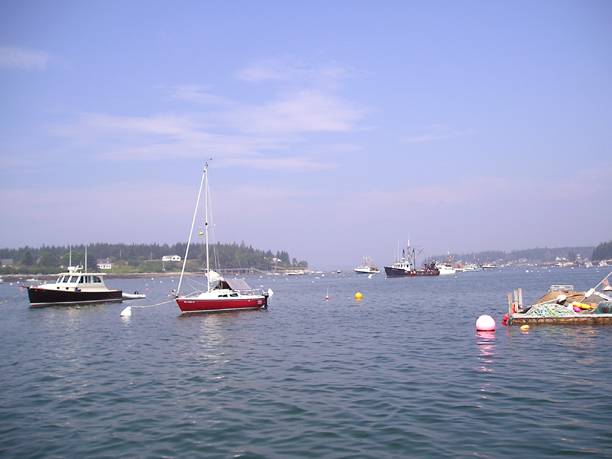
![[Chart]](maine05/charts/NE_Harbor.jpg)
![[Chart]](maine05/charts/Eastern_Harbor.jpg)